|
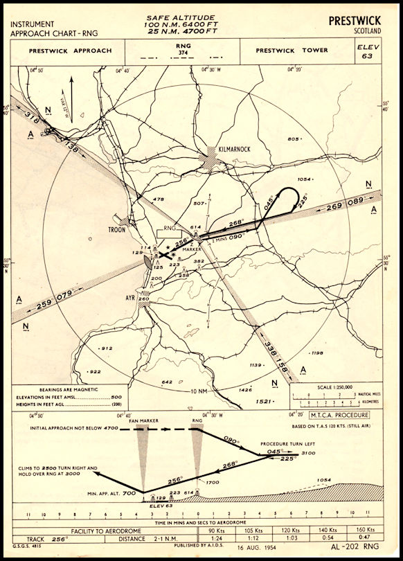
Approach
chart for Prestwick Airport showing the Radio Range used as an approach
aid. The south east leg of the range was used to define airway Amber
One, down to Dean Cross in England and onwards to London. The range
was not actually on the airport and a course correction was needed to align
with the runway after passing over the beacon.
|